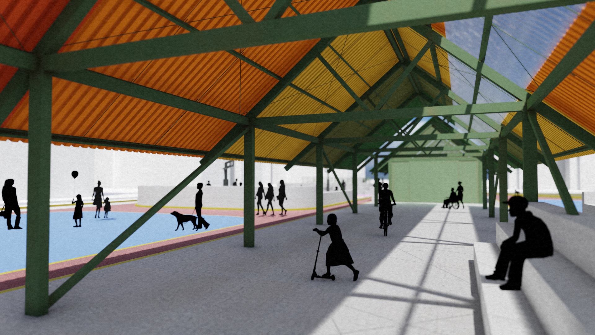
As part of a public-space rehabilitation initiative developed for INFONAVIT, I participated at Amasa Estudio in the redesign of a community recreation area located in Culhuacán, Mexico City. The project sought to recover an underused open space surrounded by housing complexes and educational facilities, transforming it into a safer, more accessible, and active environment for residents of different ages.
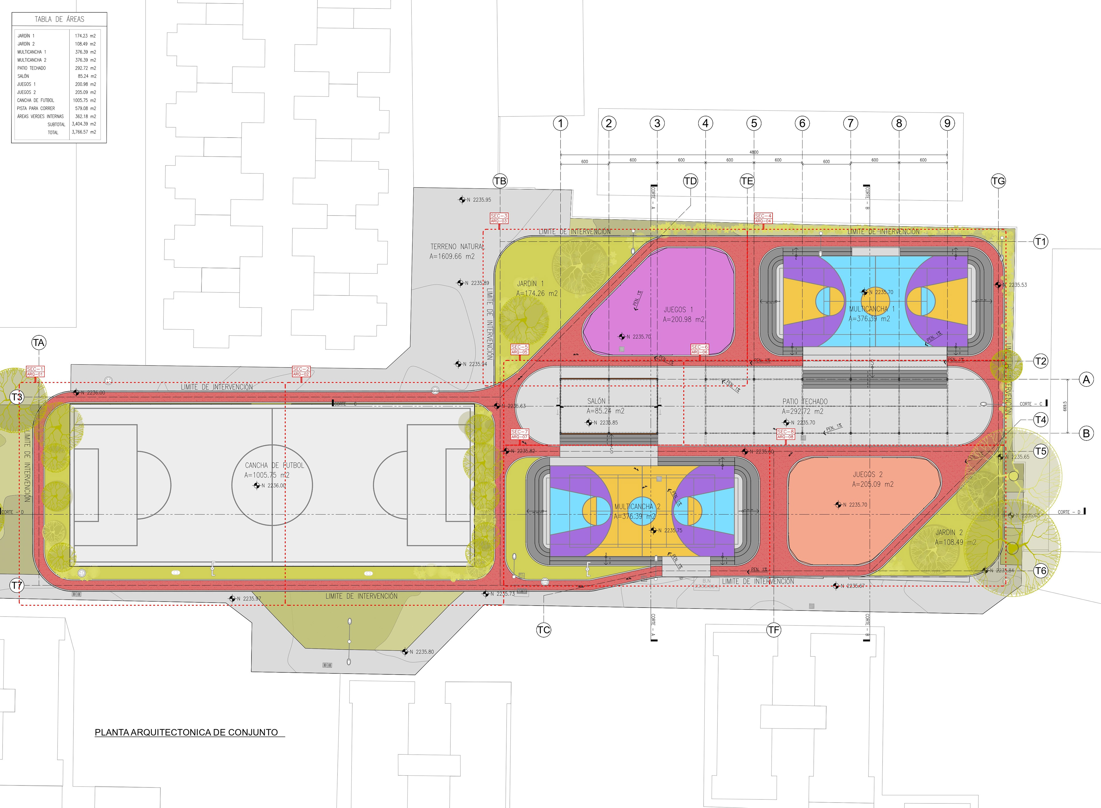
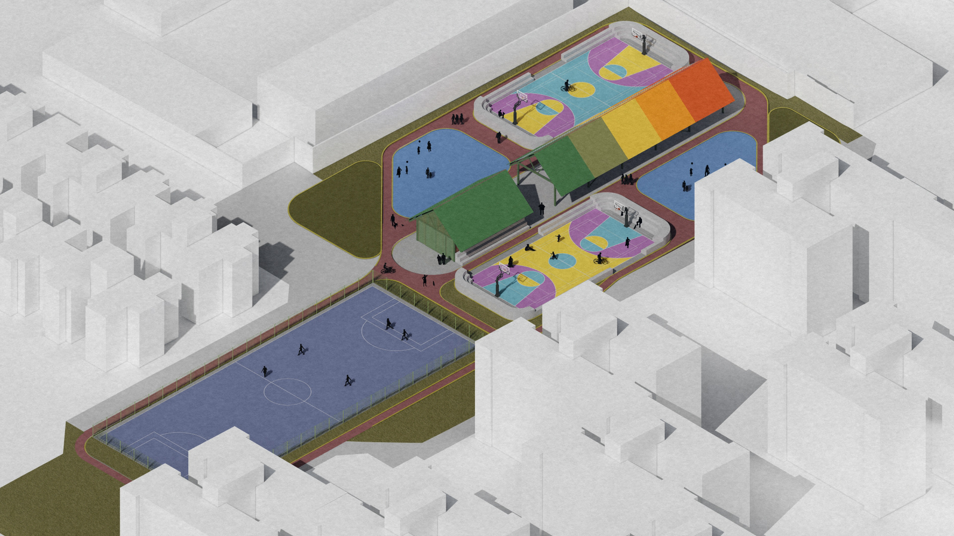
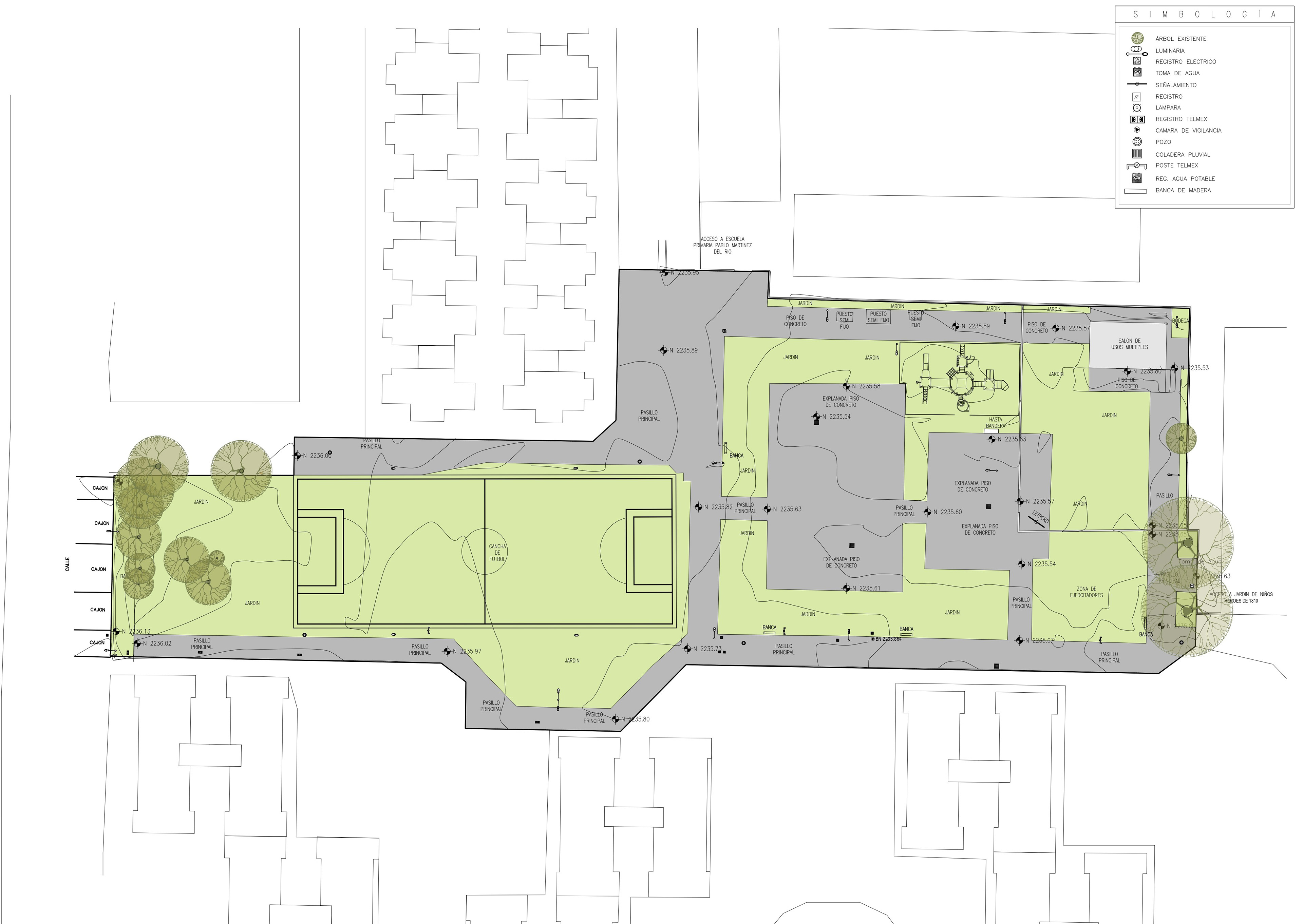
The existing site already contained several community amenities, including exercise areas, a central plaza, a multipurpose room, and a children’s playground. The design challenge was to preserve and integrate these elements while incorporating a new running track with a predetermined length, two additional multipurpose courts, a fast-football field, recreational areas, landscaped spaces, and a new covered multipurpose pavilion.
The spatial organization was developed through a series of interconnected, cell-like geometries that define the different recreational zones while adapting to the irregular conditions of the site. A continuous jogging track links the sports courts, playgrounds, gathering areas, and community facilities, becoming the main circulation element and giving visual unity to the proposal.
Rather than treating each activity as an isolated component, the design establishes a connected sequence of spaces that encourages movement, recreation, social interaction, and community use. The project also introduces new vegetation, seating areas, accessible pathways, and transition zones between the residential surroundings and the sports facilities.
My participation included the development of the site layout, architectural plans, sections, spatial studies, construction details, and visualization materials. I also worked on the modeling and coordination of the existing topography, levels, paving surfaces, and rainwater drainage strategy, using Revit and AutoCAD to translate the proposal into a coordinated architectural documentation package.
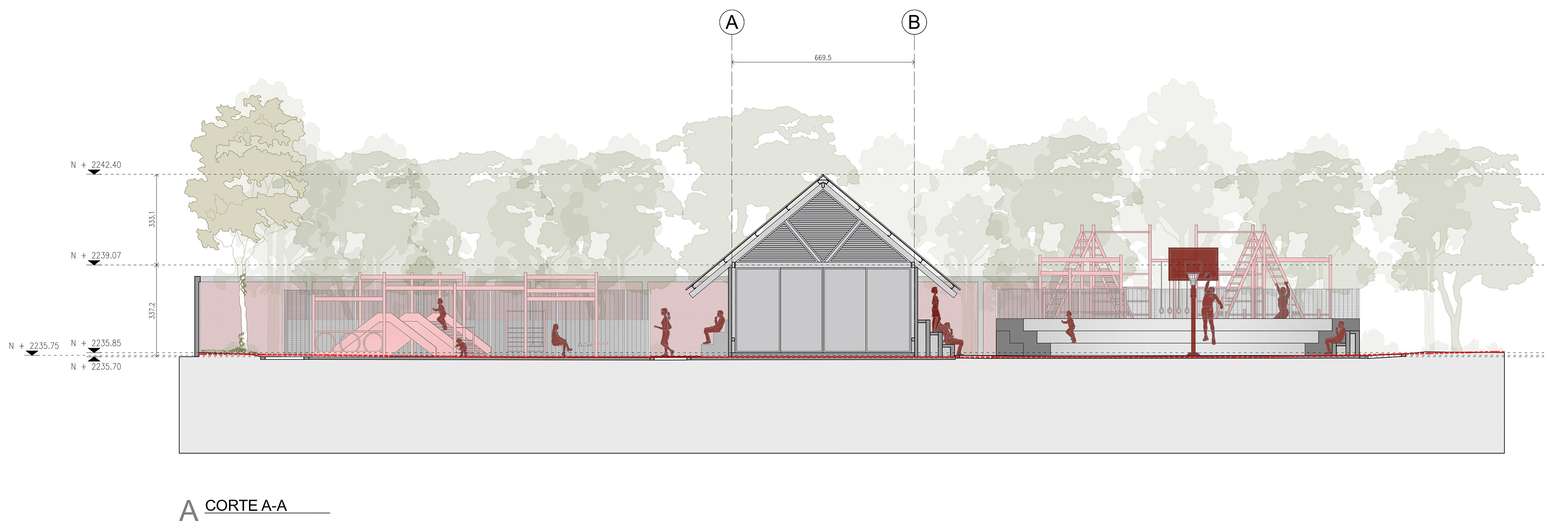
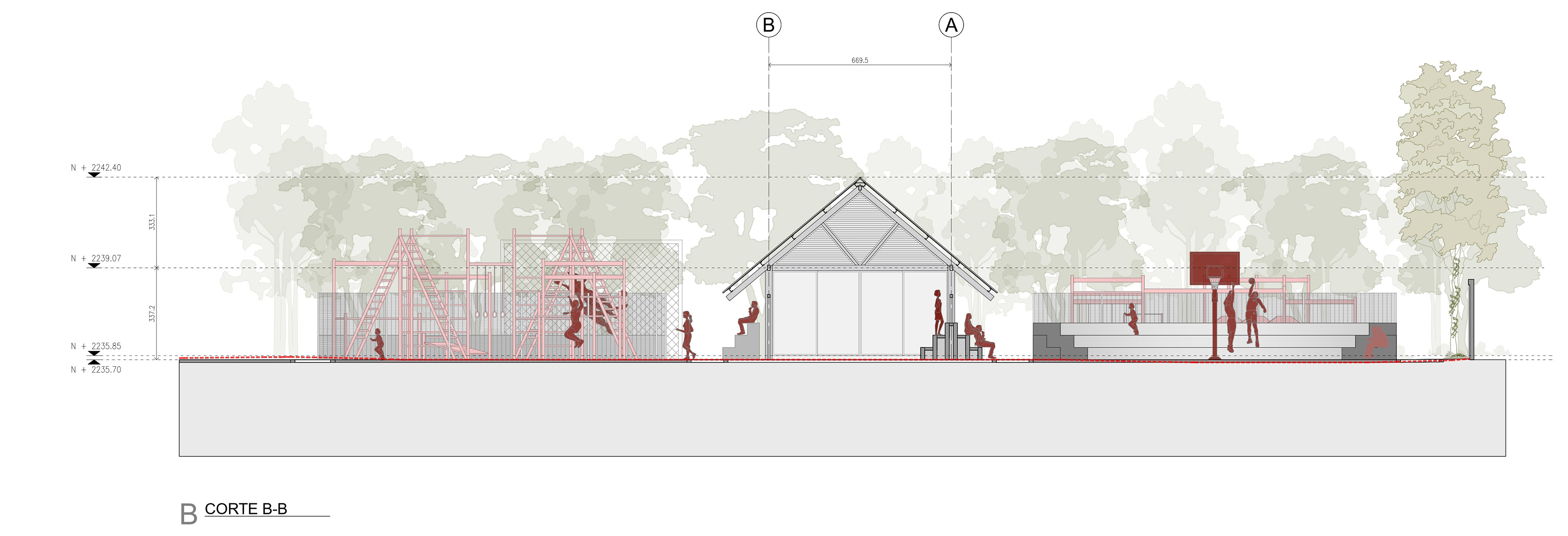
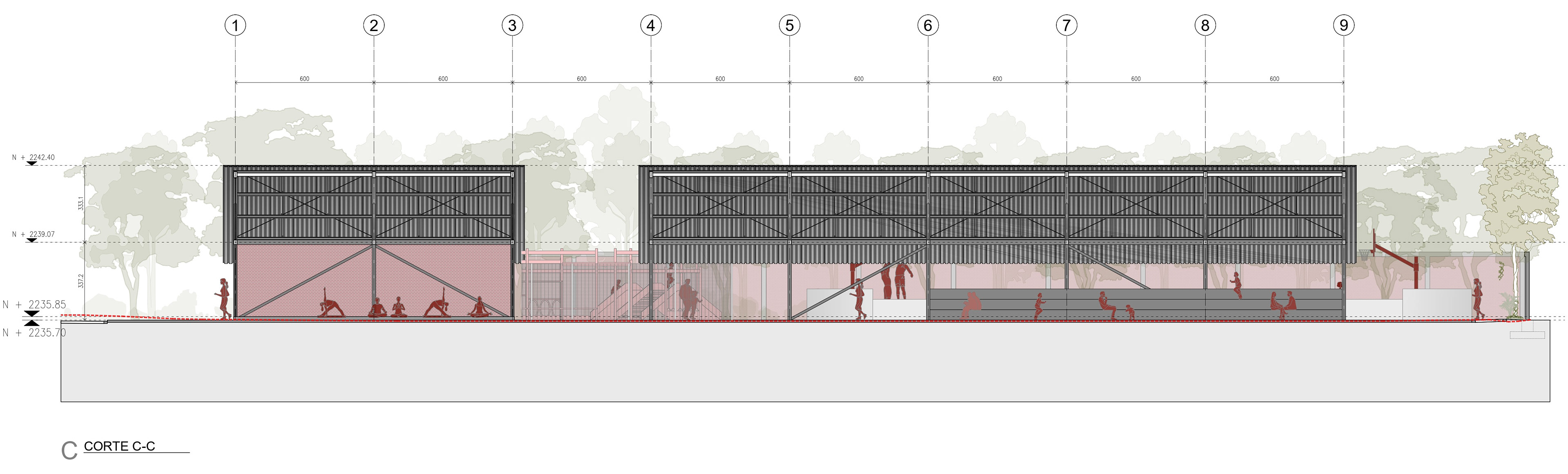
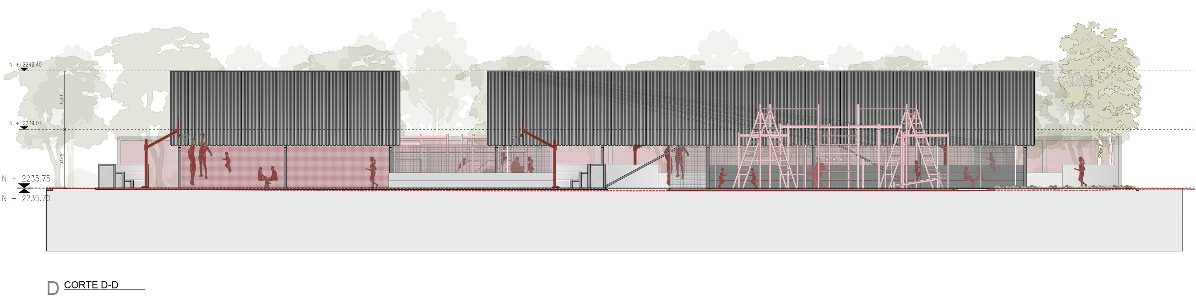
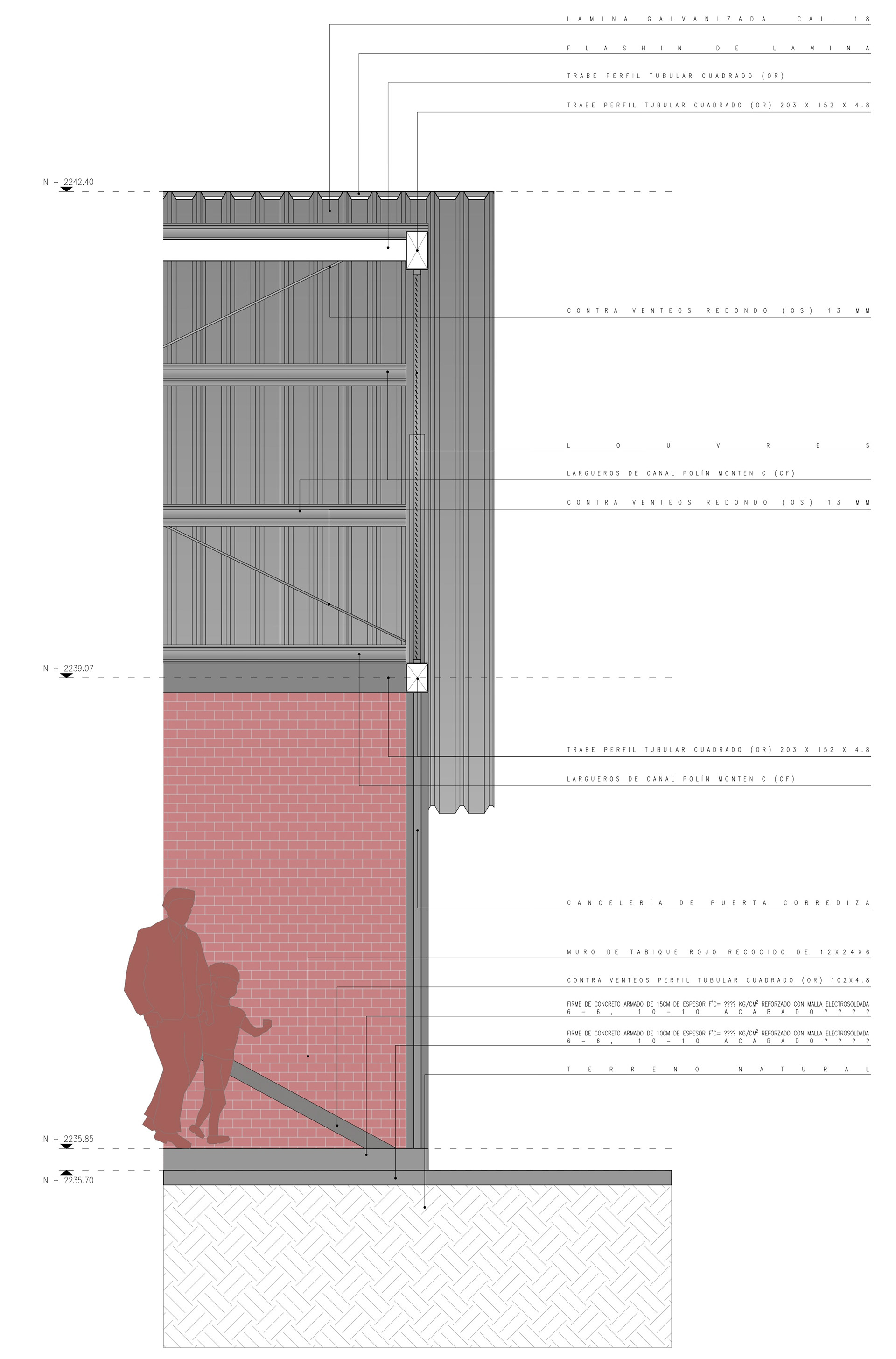
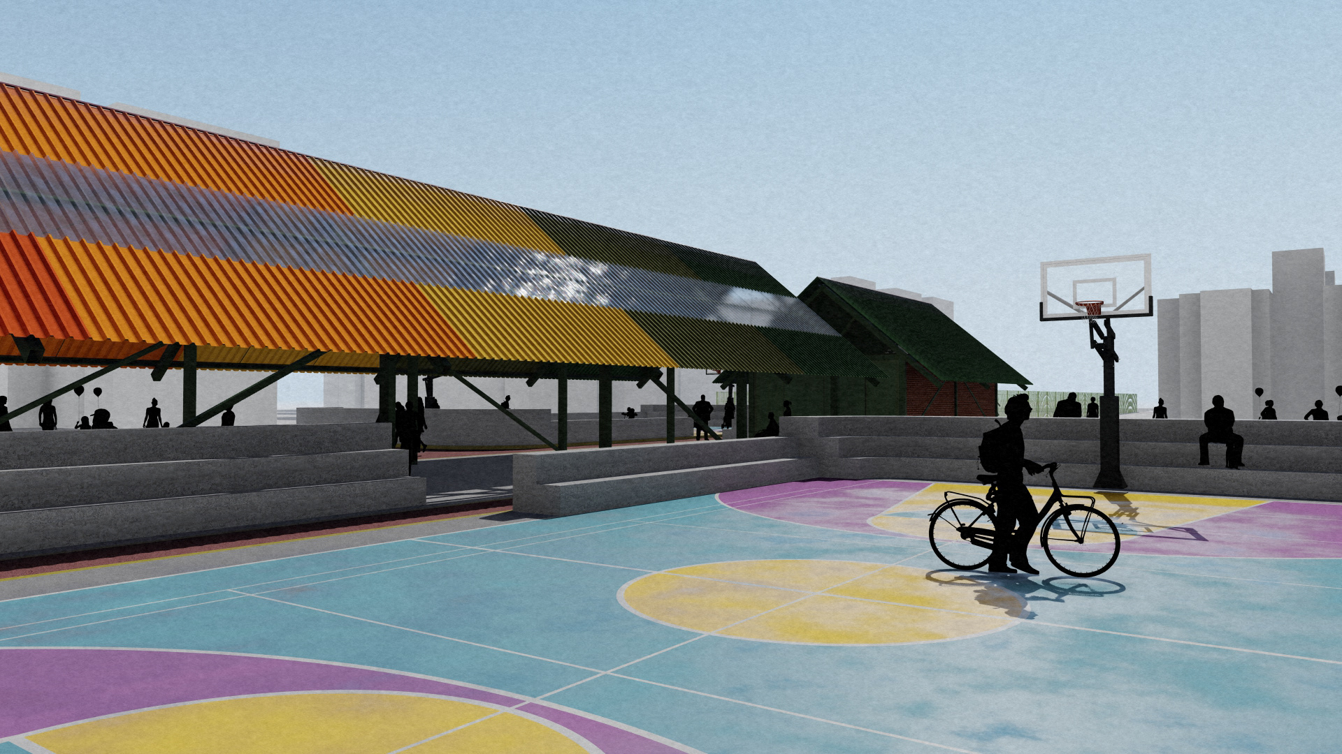
The following selection presents the existing-site analysis, general master plan, architectural sections, construction details, and visualizations produced during the development of the project.
Formal credits of the proposal: Amasa Estudio
Site and Technical Development
The existing site presented significant variations in elevation, with pavements, recreational areas, and access points located at different levels. These conditions had to be carefully documented and incorporated into the design to ensure continuity between the proposed circulation routes, sports areas, and existing infrastructure.
The topographic model was developed in Revit and later coordinated and documented in AutoCAD. This process supported the definition of slopes, finished floor levels, accessible routes, pavement transitions, and the placement of new rainwater collection points.
The drainage strategy was particularly important because the intervention introduced extensive new paved surfaces and sports courts. The proposal therefore considered the natural slope of the terrain to guide runoff toward the new drainage system while reducing potential water accumulation within the main activity areas.
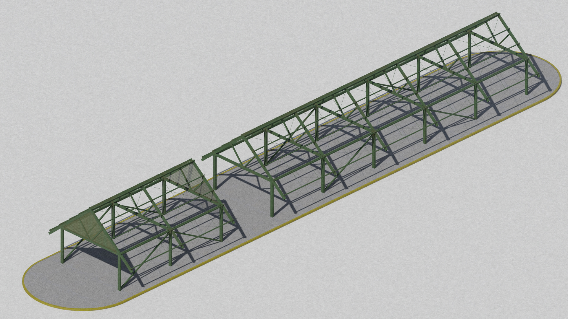
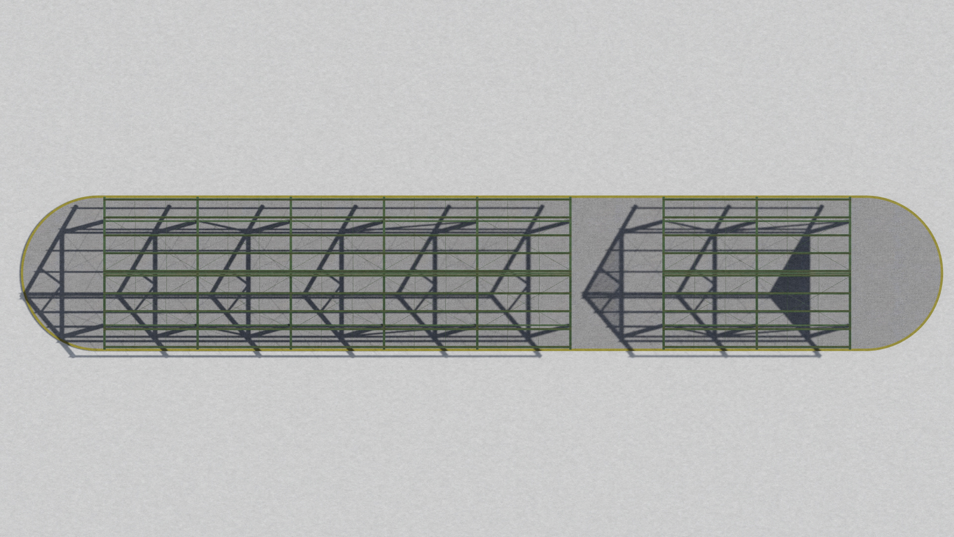
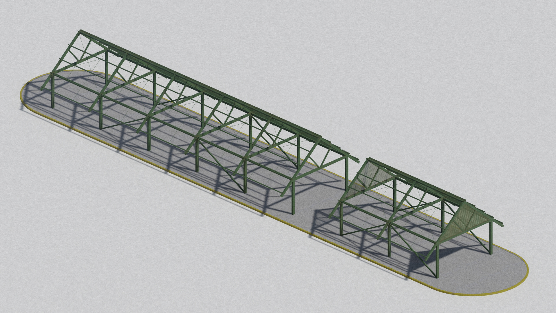
The architectural sections and construction details further developed the relationship between the new covered pavilion, courts, landscaping, and surrounding residential context. Particular attention was given to the pavilion’s lightweight metal structure, roof enclosure, ventilation, and connection to the existing ground conditions.